Odisha to experience rain as Cyclone Hamoon intensified into severe cyclonic storm
In the next 12 hours, the cyclonic storm ‘Hamoon’ will become more powerful and turn into a severe cyclonic storm.
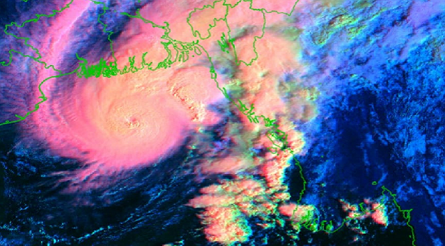
Bhubaneswar: The deep depression over the Bay of Bengal has turned into a cyclonic storm today. In the next 12 hours, the cyclonic storm ‘Hamoon’ will become more powerful and turn into a severe cyclonic storm.
As of now, the cyclone is heading in a north-northeast direction at a speed of 14 kilometres per hour and crossing Bangladesh.
The centre of Cyclone Hamoon is currently located 230 kilometres south-southeast of the Paradip coast, 360 kilometres south of Digha in West Bengal, and 510 kilometres south-southwest of Khepupura in Bangladesh.
The IMD predicts that in the next 12 hours, the Hamoon may intensify further into a severe cyclonic storm or severe storm.
Later on, it is expected to shift its course in a north-north-east direction. By the evening of October 25th, it is likely to make landfall between Kheppura and Chittagong as a deep depression on the Bangladesh coast.
Importantly, Odisha is not expected to be directly affected by this cyclone. However, some coastal districts of Odisha could experience light to moderate rainfall until October 25th.
In anticipation of heavy rainfall, a yellow warning has been issued for three districts: Bhadrak, Kendrapara, and Jagatsinghpur, with the possibility of heavy rainfall over the next 24 hours.
Fishermen are advised not to venture into sea along and off Odisha coast and West central and
North Bay of Bengal till 25 October.


 Ms Kalinga