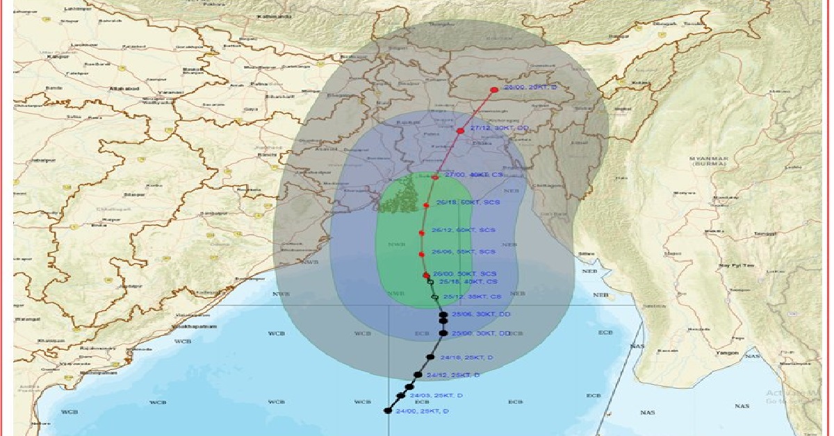
Bhubaneswar: The India Meteorological Department (IMD) has said that the low-pressure area over the Bay of Bengal that intensified into a cyclonic storm named Remal is likely to make landfall between the coasts of West Bengal and Bangladesh as a severe cyclonic storm today.
As per the weather department, the cyclone is set to intensify into a severe cyclonic storm in next six hours. Additionally, the IMD has issued warning for heavy to very heavy rainfall to coastal districts of West Bengal and north Odisha on May 26 and 27 due to the impact of the cyclone.
Sharing about the cyclone updates, IMD tweeted, “Cyclonic Storm RemaL over North BoB intensified to Severe Cyclonic Storm about 270km SSE of Sagar Islands(WB). To move northwards, intensify further and cross Bangladesh and adj West Bengal coasts by midnight today as Severe Cyclonic Storm with max wind speed of 110-120 kmph.”
Notably, the landfall is expected sometime around midnight on Sunday. While a control room has been set up at the Kolkata Police headquarters in Lalbazar for the state agencies, teams of the National Disaster Response Force (NDRF) are heading for the districts that are likely to be affected by the cyclonic storm.
The Indian Coast Guard (ICG) is also issuing alerts to mariners besides coordinating with its Bangladeshi counterparts for proper handling of the situation.
The NDRF, meanwhile, has deployed 12 teams with equipment in seven districts. While one team will be deployed in Kolkata, there will be two each in the districts of North 24-Parganas, East Midnapore, and West Midnapore.
Three teams have been deployed in South 24-Parganas which is expected to be hit the hardest. The remaining teams will be stationed at Howrah and Hooghly.


