
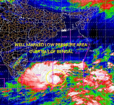
Bhubaneswar: The Low Pressure Area over over southwest & adjoining southeast Bay of Bengal persists. It is very likely to concentrate into a depression over Southwest Bay of Bengal during next 24 hours and intensify further into a cyclonic storm during subsequent 24 hours, informs India Meteorological Department (IMD).
It is very likely to move northwestwards and cross Tamil Nadu and Puducherry coasts between Karaikal and Mahabalipuram around 25th November 2020 noon/afternoon.
There will no impact on Odisha.
Under the influence, rainfall activity is likely to increase over extreme south Peninsula from 23rd onwards with fairly widespread to widespread activity over Tamilnadu during 24th-26th, over south Coastal AP, Rayalseema and Telangana on 25th & 26th November.
There will be extremely heavy rainfall over Tamilnadu, Puducherry & Karaikal during 24th-25th November; over south Coastal Andhra Pradesh & Yanam, Rayalseema on 25th-26th November; over Telangana on 26th November, 2020.
The fishermen are advised not to venture into Equatorial Indian Ocean & adjoining central parts of South Bay of Bengal on 22 Nov; into southwest & adjoining Westcentral Bay of Bengal, Gulf of Mannar, along & off Tamilnadu, Puduchery & south Andhra Pradesh coast between 22-25 Nov.

 Ms Kalinga