
Low pressure system in Bay of Bengal may intensify into cyclone ‘Hamoon’
A low-pressure area has formed in the south-central and adjacent southeast regions of the Bay of Bengal which may intensify to a cyclone.
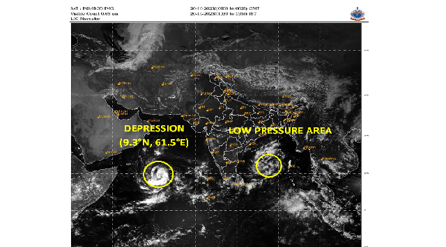
Bhubaneswar: A significant meteorological development is unfolding over the Bay of Bengal, as a low-pressure area has formed in the south-central and adjacent southeast regions of the bay. This atmospheric disturbance is influenced by a pre-existing cyclonic circulation within the area.
Weather experts predict that this system will intensify and gradually drift towards the west-central and northwest Bay of Bengal. Projections indicate that within the next 48 hours, this system will evolve into a depression, slated for October 22. Furthermore, there is a high likelihood of the system advancing to the status of a deep depression on October 23.
While the system is set to make a north-northeastward course parallel to North Odisha and the Bengal Coast, it is expected to maintain a safe distance from the coastal regions.
Early indicators suggest that this system might further intensify into a mild cyclonic storm, potentially around October 24th-25th. However, it is vital to recognize that such forecasts are still in a preliminary stage.
Should this system continue its development and indeed attain cyclonic storm status, it will be officially named ‘Hamoon.’
On the other hand, a low-pressure area over the southeast and the adjoining southwest Arabian Sea has developed into a depression and is expected to intensify into a cyclonic storm by the morning of October 21, confirmed Indian Meteorological Department (IMD).

 Ms Kalinga