
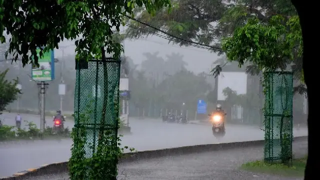
IMD issues heavy to very heavy rainfall in Odisha, SRC chairs preparatory meeting with 18 district collectors
Odisha Special Relief Commissioner (SRC) Deoranjan Kumar Singh on Thursday chaired a preparatory meeting with 18 district collectors following the heavy to very heavy rainfall prediction of the regional centre of the India Meteorological Department (IMD).
Bhubaneswar: Odisha Special Relief Commissioner (SRC) Deoranjan Kumar Singh on Thursday chaired a preparatory meeting with 18 district collectors following the heavy to very heavy rainfall prediction of the regional centre of the India Meteorological Department (IMD).
The SRC held the preparatory review meeting via video conferencing with the District Collectors of Nabarangpur, Koraput, Malkangiri, Rayagada, Gajapati, Kalahandi, Kandhamal, Ganjam, Nayagarh, Puri, Khurda, Jagatsinghpur, Cuttack, Kendrapara, Jajpur, Bhadrak, Balasore and Nuapada.
The meeting, which also discussed preparedness for possible emergency situations following heavy rainfall, was attended by the Chief Engineer of the Water Resources Department, Director of the India Meteorological Department, Executive Director of Odisha State Disaster Management Authority (OSDMA) and senior officers of the Special Relief Commissioner’s office.
During the meeting, the collectors of Koraput and Malkangiri districts, which are particularly likely to be affected by flood post heavy rainfall, were directed to remain on duty and be alert to deal with the situation.
The collectors also have been advised to deploy Fire Service personnel and Odisha Disaster Rapid Action Force (ODRAF) teams, if required.
The Drainage Engineering Officers have been directed to be ready with manpower and equipment to deal with any flood-like situation.
The SRC office advised the public not to get panic and believe any rumours as the local administrations are fully prepared to deal with any situation and the State government is also keeping a close vigil on the situation.
The weather department said that the upper air cyclonic circulation over northwest and adjoining westcentral Bay of Bengal and adjoining south Odisha-North Andhra Pradesh coasts extending upto 5.8 km above mean sea level tilting southwestwards with height persists.
The upper air cyclonic circulation over eastcentral and adjoining northeast Bay of Bengal and extended upto middle tropospheric levels persists today. It is likely to move nearly westwards gradually. Under its influence, a low-pressure area is likely to form over north and adjoining central Bay of Bengal during next 12 hours.
Moving nearly westwards, it is very likely to concentrate into a depression over northwest and adjoining westcentral Bay of Bengal off South Odisha- North Andhra Pradesh coasts on September 26. It is very likely to cross South Odisha-North Andhra Pradesh coasts around September 27 morning.
Under its impact heavy to very heavy rain and thunderstorm with lightning with gusty surface wind speed reaching 40-50 kmph and gusting to 60 kmph very likely to occur at one or two places over the districts of Koraput and Malkangiri.
Besides, heavy rain and thunderstorm with lightning with gusty surface wind speed reaching 40-50 kmph and gusting to 60 kmph very likely to occur at one or two places over the districts of Rayagada, Gajapati, Ganjam, Puri, Balasore, Khurda, Kalahandi , Nayagarh, Kandhamal and Nabarangpur.
Similarly, thunderstorm with lightning with gusty surface wind speed reaching 40-50 kmph and gusting to 60 kmph very likely to occur at one or two places over the districts of, Bhadrak, Jajpur, Kendrapara, Cuttack, Jagatsinghpur, Sonepur, Boudh, Nuapada and Balangir.
Likewise, thunderstorm with lightning with gusty surface wind speed reaching 20-30 kmph gusting to 40 kmph very likely to occur at one or two places over the districts of Sundargarh, Jharsuguda, Bargarh, Sambalpur, Deogarh, Angul, Dhenkanal and Keonjhar.