
Possibility of Cyclone Sitrang hitting coast close to Diwali
Bhubaneswar: Due to highly favourable weather conditions, a low-pressure area over the Bay of Bengal is likely to intensify into a cyclone after October 22, the India Meteorological Department (IMD) said on Tuesday.
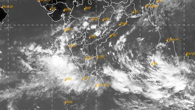
A low-pressure area is likely to form over the southeast and adjoining east-central Bay of Bengal during the next 48 hours. This low pressure area will move towards the northwest. The low pressure is expected to turn into a depression during the early hours of October 22. The depression is expected to intensify even further in the west-central Bay of Bengal.
A cyclonic storm might be formed on October 23 or 24. This cyclone will be expected to make landfall on October 24 or 25.
The route of the cyclone is not completely clear as of now. Experts can’t accurately predict where it will make landfall either. The exact route of the cyclone can be mapped with much more certainty after the depression is formed on October 22.
There is very little possibility of rainfall in the state till October 23. However, fishermen have been warned to not venture into the deep sea from October 22.
Wind speeds as high as 45 to 55 kmph are expected in west-central and adjoining northwestern Bay of Bengal on October 22, with wind strokes being as high as 65 kmph. Fishermen have been alerted as the sea is expected to be very tumultuous.

 Ms Kalinga