
Low Pressure Area forms over South Andaman Sea and adjoining Southeast BOB
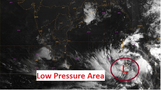
Bhubaneswar: A low pressure area has formed over South Andaman Sea and adjoining Southeast Bay of Bengal under the influence of the cyclonic circulation over South Andaman Sea & neighbourhood, informed Meteorological Centre, Bhubaneswar on May 6.
Reportedly, it is very likely to move northwestwards and intensify into a Depression during subsequent 48 hours, added MeT.
Under the influence of the cyclonic circulation over South Andaman Sea & neighbourhood, a #LowPressureArea has formed over South Andaman Sea & adjoining Southeast BayofBengal. It is very likely to move northwestwards and intensify into a Depression during subsequent 48hours. pic.twitter.com/3PrKONOuf1
— Meteorological Centre, Bhubaneswar (@mcbbsr) May 6, 2022
The cyclonic circulation has formed over South Andaman Sea and its neighborhood on May 5 and extended up to mid-tropospheric levels.
It is pertinent to mention that the possible cyclone is likely to weaken by May 11 as it will approach towards the coast of Andhra Pradesh and Odisha. Such meteorological forecasts have brought relief to the people residing in coastal areas of the two states.
According to the GFS chart, after the low pressure area intensifies into cyclonic storm by May 10- May 11, it is likely to move towards northwest near the Andhra coast. Eventually, the movement of the possible cyclone is likely to change its path.
On the other hand, European model ECMWF has predicted that the possible cyclone is likely to hit the coast on May 9- May 10.

 Ms Kalinga