
Cyclone Yaas To Make Landfall In Between Dhamra and Chandbali In Odisha
Bhubaneswar: The very Severe Cyclonic Storm Yaas over east central Bay of Bengal is likely to make landfall between Chandbali and Dhamra port on May 26, informs India Meterological Department (IMD) on Tuesday.
It is moving in North-northwestward direction at a speed of 09kmph during past six hours. It remained about 360 km south-southeast of Paradip and 460km south-southeast of Balasore.”the bulletin said.
“The phenomenon is very likely to move north-northwestwards, intensify further into a very severe cyclonic storm during next 12 hours,” it stated further.
It is very likely to cross north Odisha-West Bengal coasts between Paradip and Sagar Island around Balasore, during noon of Wednesday, the 26th May as a Very Severe Cyclonic Storm,” the bulletin said.
Wind Warning:
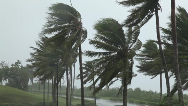
- Gale wind speed reaching 100-110 kmph gusting to 120 kmph is prevailing over major parts of central Bay of Bengal and would increase gradually become 125-135 gusting to 140 kmph from today evening.
- Squally wind speed reaching 50-60 kmph gusting 70 kmph is prevailing over North Bay of Bengal and along and off north Andhra Pradesh-Odisha–West Bengal–Bangladesh coasts.
- It would further increase becoming gale wind speed 155-165 kmph gusting to 185 kmph over northwest Bay of Bengal and along & off north Odisha and adjoining West Bengal coasts including Jagatsinghpur, Kendrapara, Bhadrak, Balasore districts of Odisha, 100-120 kmph gusting to 145 kmph over Mayurbhanj district of Odisha & East Medinipur & South 24 Parganas districts of West Bengal from early hours of 26th May.
- Squally wind speed reaching 60-80 kmph gusting to 90 kmph would prevail over Ganjam, Dhenkanal and Keonjhar districts of Odisha and Bankura, Purulia, Howrah, Hooghly, Nadia & Burdwan districts of West Bengal from 26th early hours. Squally wind speed reaching 50-60 kmph gusting to 70 kmph would prevail over Angul, Deogarh & Sundargarh districts of Odisha, Birbhum & Murshidabad districts of West Bengal and Srikakulam, Vizianagaram and Visakhapatnam districts of Andhra Pradesh during same period.
- Squally wind speed reaching 50-60 kmph gusting to 70 kmph over Kendrapara, Bhadrak, Balasore, Mayurbhanj, Keonjhar, Sundergarh and Deogarh districts of Odisha and West Medinipur, Jhargram, Bankura & Purulia districts of West Bengal on 27th.
Storm surge warning: Tidal waves of height 2-4 meters above astronomical tide are likely to inundate low lying low laying areas of Medinipur, Balasore, Bhadrak and about 2 meters above astronomical tide are likely to inundate low lying low laying areas of South 24 Parganas, Kendrapara and Jagatsinghpur Districts around the time of landfall.
The fishermen are advised not to venture into central Bay of Bengal till 26th May forenoon and into north Bay of Bengal and along off north Andhra-Pradesh-Odisha-West Bengal-Bangladesh coasts during 25th-26th May. Those who are out in the Deep sea of north and adjoining central Bay of Bengal are advised to return to the coast.

 Kalinga AI