
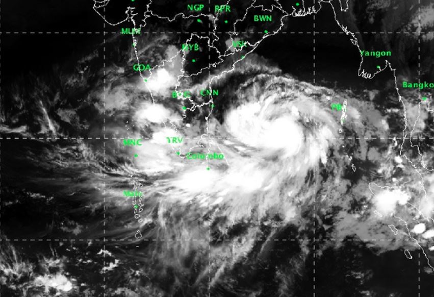
Bhubaneswar: The regional centre of the India Meteorological Department (IMD) on Tuesday said that Cyclone Fani’s impact in Odisha will be more severe than that of Cyclone Titli.
The cyclone is very likely to intensify further into an ‘Extremely Severe Cyclonic Storm’ during next 36 hours. It is very likely to move northwestwards till May 1 evening and thereafter recurve north-northeastwards towards Odisha coast, an IMD bulletin said.
Earlier, it was being speculated that the cyclone will hit Odisha coast between Puri’s Satpada and Chandrabhaga. However, the National Disaster Management Authority has forecasted that the storm is likely to make landfall on the coastline between Bhadrak and Balasore.
It will trigger heavy to very heavy rainfall in the south and east coastal districts while there will be isolated heavy rainfall at one or two places in the north Odisha districts.
Squally wind speed reaching 40-50 kmph gusting to 60 kmph is very likely to be experienced along & off Odisha coast from May 2. It may reach 60-80 kmph by the morning of May 3.
The sea will be very rough from May 2-4. Fishermen have been advised not to venture into the sea during this time.
Also Read: IMD Predicts Rain, NERC Issues Advisory For Odisha As Cyclone ‘Fani’ Intensifies

 Kalinga AI