
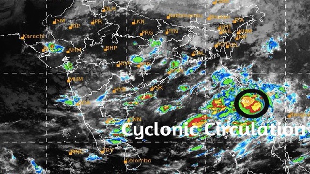
Bhubaneswar: The cyclonic circulation lies over Myanmar coast and adjoining Gulf of Martaban, informed Meteorological Centre Bhubaneswar on Thursday. It is likely to move northwestwards and emerge into Northeast and adjoining East central Bay of Bengal.
Reports said that under its influence, a low pressure area is likely to form over the same region around evening of September 24. It is expected to touch Odisha coast by September 26 due to which the state will receive heavy rainfall from September 25.
The low pressure area is currently swirling in the southeast part of Jharkhand, which has extended to the interior areas of Odisha, added reports.
As a result, five districts of Odisha including Keonjhar, Deogarh, Sundargarh, Sambalpur and Jharsuguda have been issued yellow warning. Fishermen are advised not to venture along and off Odisha-West Bengal coast and North West Bay of Bengal.
Odisha Special Relief Commission (SRC) directed all the district collectors to stay alert for any emergency situation that may arise due to rainfall triggered the low pressure.
It is to be noted that, the rainfall has dropped by 11 percent below normal since June 1. As many as eight districts have been recorded with deficit of rainfall.
Also read: Another low pressure to form over BoB By September 11

 Ms Kalinga