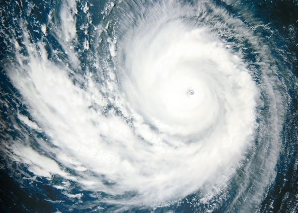
New Delhi: In view of likely cyclonic storm formation over south Arabian Sea around May 15 and its likely north-northwestwards movement, heavy to very heavy rainfall is expected at a few places over Kerala and Lakshadweep on May 14-15 and also over of Tamil Nadu and south Karnataka on May 15.
Fishermen are advised not to venture out to the southeast Arabian Sea and adjoining Maldives, Comorin and Lakshadweep area, Kerala coast from morning of May 13. East central Arabian sea and along and off Karnataka-Goa and Maharashtra and Goa coasts from May 14 in the night. All those who are in the sea have been advised to return to the coast by the night of May 12.
There is likely confluence of winds from Arabian Sea and easterly winds at lower levels over northwest India during next 3-4 days. Under their influence, fairly widespread rainfall with isolated thunderstorm/lightning/gusty winds & hailstorm likely over Western Himalayan Region and over plains of northwest India during next 3- 4 days.
Isolated heavy rainfall is also likely over Jammu & Kashmir on May 12, over Himachal Pradesh & Uttarakhand on May 12 & 13 and over Punjab on May 13.
Under the influence of above mentioned east-west trough at lower levels and north-south trough over northeast India at middle tropospheric levels, scattered to widespread rainfall/thunderstorm activity is very likely over northeastern states and West Bengal & Sikkim and isolated to scattered rain/thundershower over rest parts of east India during next five days.
Isolated heavy rainfall over Assam & Meghalaya on May 11 & 12, Tripura on May 11, Sub Himalayan West Bengal & Sikkim on May 11 & 12 and over Gangetic West Bengal from May 11 & 12.
No heat wave is likely over any part of the country during next five days.


 Ms Kalinga